Risk analysis of climate and natural hazards
Thanks to comprehensive climate data and vulnerability studies, we help you identify the effects of global warming on individual locations and environments at an early stage and use appropriate strategies to reduce future heat exposure.
Climate

Climate change is leading to rising temperatures and heat extremes. Throughout the whole of Switzerland, we will see a sharp increase in the number of heatwave days, i.e. those with temperatures above 30 degrees.
Using climate data from satellites, administrative data, and measurements from private weather stations, we enable you to identify possible conflicts to your urban planning objectives at an early stage.
Dense building development and the large proportion of sealed surfaces mean that climate change will hit cities particularly hard. This is already a health burden for the population –– rising temperatures can not only result in reduced work productivity and well-being but also contribute to increased mortality.
Because temperature can vary significantly within a city, the effects of global warming differ greatly by location and environment. An accurate understanding of spatial temperature variation is therefore essential for urban planning.
We combine satellite data, open and free-use administrative data, and measurements from private weather stations using machine learning to create high-resolution heat maps. These maps can serve, for example, as a basis for vulnerability analyses or to highlight potential conflicts of objectives. Climate models can also be used to forecast future heat extremes.
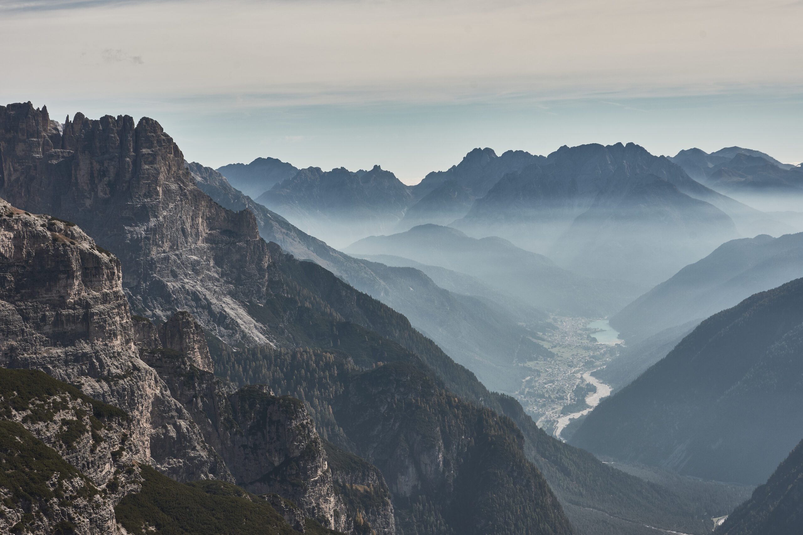
Natural hazards
Natural hazards and extreme weather events have always posed a threat to people, property, and infrastructure. Particularly in densely populated countries, the material value of real estate and infrastructure is high, as are the risks posed by natural hazards such as landslides or mudslides. Accordingly, protection and assessment of the hazard potential for real estate are of paramount importance.
Climate change also affects the probability and intensity of weather extremes and natural hazards. According to the World Economic Forum’s Global Risk Report, weather extremes are the risk with the highest probability of occurrence and above-average impact.
It is difficult to predict exactly where and when an event will cause damage to a building. Hazard maps, which depict exposure as a combination of probability and intensity of specific natural hazards, can solve this by determining the risk at a site or area. However, in order to estimate the specific risk to a property, we must also consider its vulnerability and value. For example, properties with an underground garage or basement are more susceptible to surface runoff.
In this study, we were able to empirically determine the impact of natural hazards on the price of single-family homes and condominiums. We can see that individual natural hazards have value-reducing effects, but at the same time, construction continues in vulnerable areas.
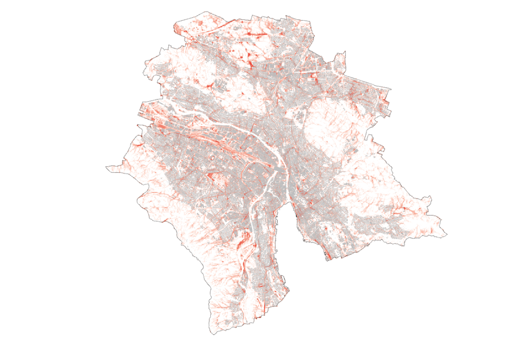
Surface runoff
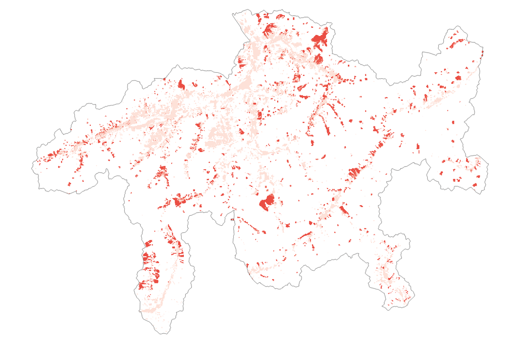
Avalanche risk
Earthquake
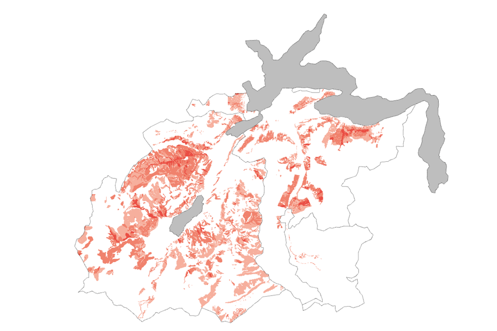
Landslide (Nidwalden/Obwalden Canton)
Talk to our experts
Vulnerability & risk
The risks of natural hazards or climate change must be taken into account in site analyses. To better map the exposure of properties and real estate portfolios, we have built a comprehensive climate and natural hazard database.
Wüest Dimensions, the leading real estate management platform, contains data sets on floods, surface runoff, storms, hail, debris flows, mudslides, landslides, avalanches, earthquakes, and radon. With the ability to consult the risk of each natural hazard for the entire Swiss residential area and partly visualize it on a map, you can assess the hazard potential and take appropriate measures where necessary.
In addition to natural hazards, you can also account for climate hazards, such as current and future heat days (>30°) and cooling degree days. These not only affect the building structure (maintenance), but they can also have a significant impact on operating costs.
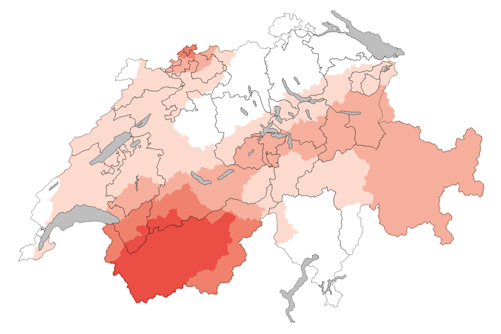
Portfolio analysis
- Risk perspective allows the comparison of real estate portfolios against each other or specific benchmarks.
- Influence of climate change on variables relevant to the real estate sector, e.g. heavy rainfall, storms, hot days, cooling degree days, and heating degree days.
- This can be used to better understand the credit risk of mortgage portfolios regarding physical climate risks.
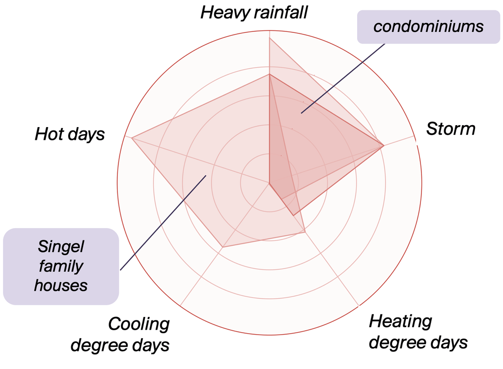
Illustration: Real estate portfolio comparison: Natural hazards